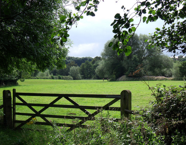
andbach walks offer some excellent countryside routes within easy reach of the town. From woodland trails around Brereton Heath to riverside paths along the Dane Valley and the flat traffic-free Wheelock Rail Trail, there are several enjoyable walking routes close to Sandbach.
Many of these Sandbach walks combine countryside footpaths, woodland tracks and railway trails with traditional pubs or cafés at the end of the route. This guide highlights a selection of walks in the Sandbach area where you can finish with a drink, meal or coffee nearby.
Most routes are located within a short drive of Sandbach and use established public footpaths rather than roadside walking, making them ideal for relaxed countryside exploring. Sandbach walks like these are ideal for combining countryside exploring with a pub stop at the end.
To help you navigate these walks near Sandbach, it’s best to use this guide alongside Google Maps and the Cheshire East public rights of way map.
Map of Walks Near Sandbach
The walks in this guide are spread across several excellent countryside areas within easy reach of Sandbach. Most routes are located within a 10–15 minute drive of the town centre and use established trails, riverside footpaths and woodland paths.
The main walking areas covered in this guide include:
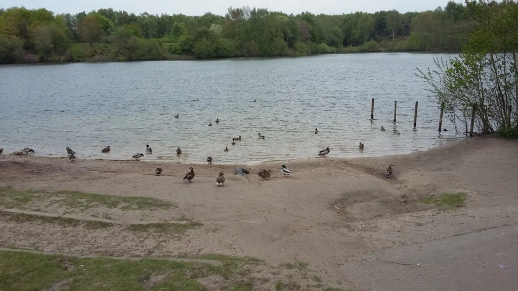
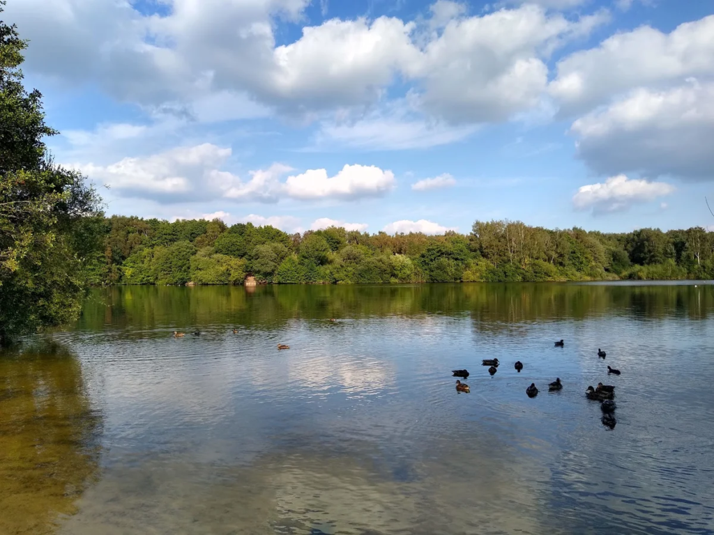
• Brereton Heath Country Park – woodland paths and lake walks
• Dane Valley & Swettenham – countryside footpaths following the River Dane
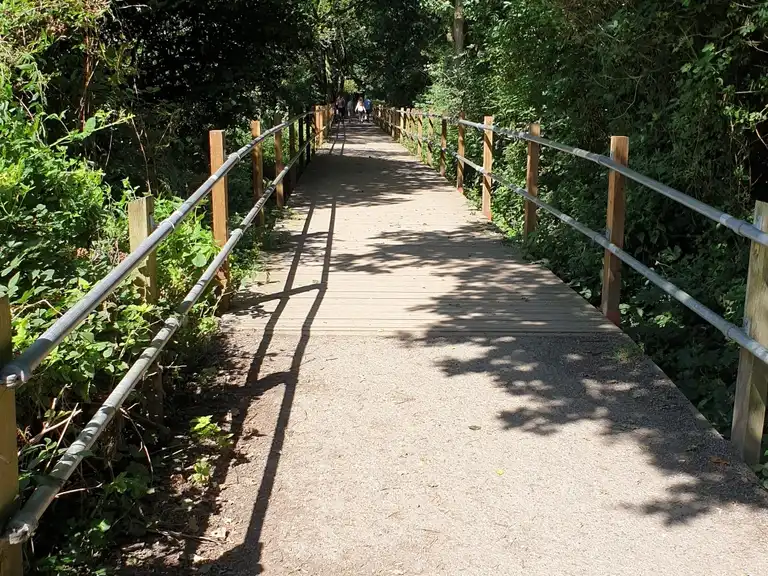
• Wheelock Rail Trail – a flat traffic-free railway path near Sandbach
• Salt Line Trail – a woodland railway trail near Hassall Green
Many of these routes naturally connect with traditional countryside pubs or cafés, making them ideal for combining a walk with a drink or meal.
Sandbach Walks Near Pubs and Cafés
To aid in your walks near near Sandbach please use this guide with the fo
Walk 1 – Brereton Heath, Quinta Arboretum & Swettenham Arms
Distance: ~6 miles
Difficulty: Easy–moderate
Start point: Brereton Heath Country Park
Finish pub: Swettenham Arms
Route
- Start at Brereton Heath Country Park car park and follow the circular path around the main lake through woodland and heathland.
- Leave the car park heading north toward the A54 and cross over onto Davenport Park Lane and follow.
- Continue along countryside footpaths toward Swettenham village.
- Follow signs toward Swettenham Church and continue along the public footpath behind the churchyard.
- The path leads toward the Swettenham Arms, a well-known walkers’ pub in the village.
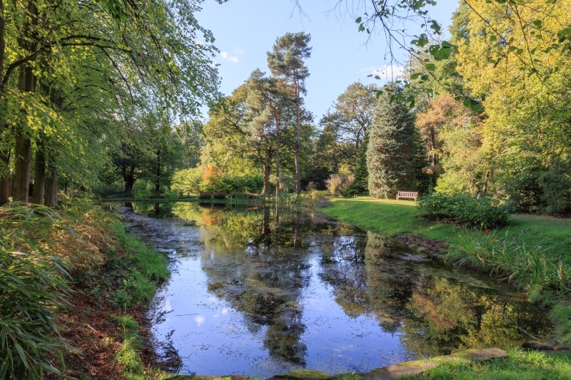
- After the pub stop, cross into Lovell Quinta Arboretum using the woodland footpaths directly behind the pub.
- Follow the arboretum’s woodland trails before leaving via countryside paths heading back toward Brereton Heath or stop at the pub for food and drinks.
Pub stop
Swettenham Arms – a historic countryside pub popular with walkers exploring the Dane Valley.
Navigation
Start point:
https://maps.google.com/?q=Brereton+Heath+Country+Park
Finish pub:
https://maps.google.com/?q=Swettenham+Arms
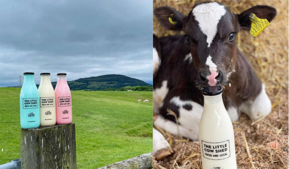
Walk 2 – Brereton Heath Lakes & Little Cow Shed Walk
Distance: ~3 miles
Difficulty: Easy
Start point: Brereton Heath Country Park
Finish stop: Little Cow Shed café
Route
- Start at Brereton Heath Country Park car park.
- Walk the full lake circuit path, which circles the water through woodland and heathland.
- From the southern side of the lake follow the public footpath heading east toward Davenport Lane.
- Continue along countryside footpaths through fields.
- Follow the path toward the farm buildings where The Little Cow Shed café is located.
Finish stop
Little Cow Shed – a popular farm café close to Brereton Heath that’s often used by walkers and cyclists.
You can also walk to The Bears head via Brereton Hall.
Navigation
Start point:
https://maps.google.com/?q=Brereton+Heath+Country+Park
Finish stop:
https://maps.google.com/?q=Little+Cow+Shed+Brereton
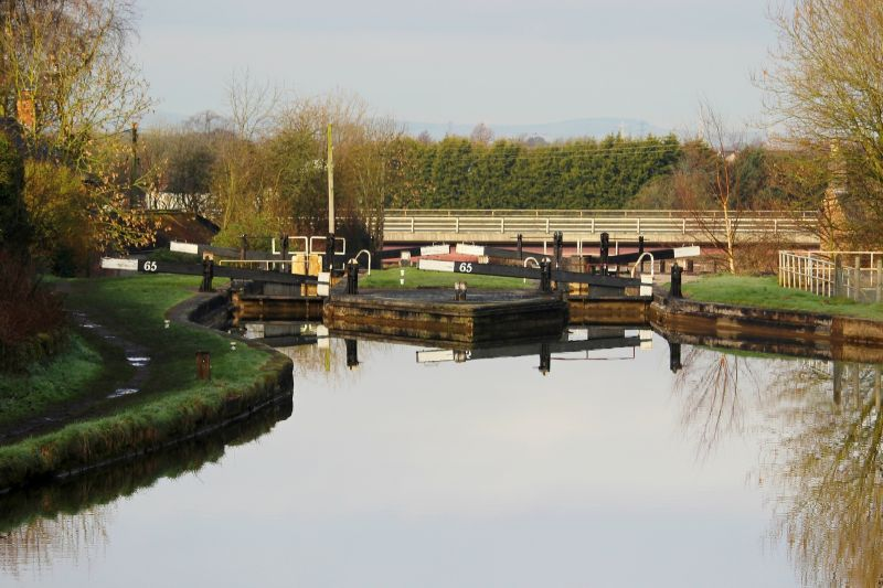
Walk 3 – Wheelock Rail Trail & Canal Walk
Distance: ~5 miles
Difficulty: Easy
Start point: Ettiley Heath Rail Trail access
Finish pub: Cheshire Cheese
Route
- Start at the Wheelock Rail Trail entrance near Ettiley Heath.
- Follow the traffic-free railway path west toward Wheelock village.
- Continue along the trail through woodland and open countryside until reaching the canal bridge at Wheelock.
- Join the Trent & Mersey Canal towpath and walk north along the canal for a short distance.
- Leave the canal and follow local footpaths back toward the village centre.
Pub stop
Cheshire Cheese – a traditional canal-side pub popular with walkers using the Rail Trail.
Navigation
Start point:
https://maps.google.com/?q=Wheelock+Rail+Trail+Ettiley+Heath
Finish pub:
https://maps.google.com/?q=Cheshire+Cheese+Wheelock
Walk 4 – Twemlow Green to The Vicarage (River Dane Walk)
Distance: ~4–5 miles
Difficulty: Easy–moderate
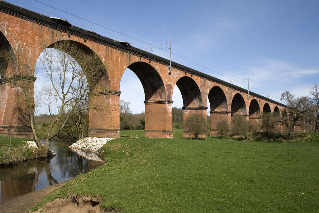
Start point: Twemlow Green lay-by near Holmes Chapel Viaduct
Finish pub: The Vicarage
Route
- Park at Twemlow Green near the Holmes Chapel railway viaduct.
- Walk a short distance along the verge until reaching the public footpath entrance beside the railway.
- Follow the footpath downhill toward the River Dane.
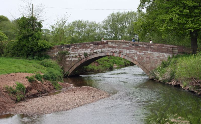
- Join the riverside path and follow it beneath the Holmes Chapel railway viaduct.
- Continue along the River Dane footpath, keeping the river to your left.
- Follow the path across fields until reaching Hermitage Bridge.
- Cross the lane and continue along the riverside path with the river now on your right.
- Follow the path through meadows until reaching Knutsford Road near The Vicarage.
Pub finish
The Vicarage – a historic building beside the River Dane that now operates as a pub and hotel.
Navigation
Start point:
https://maps.google.com/?q=Twemlow+Green+Holmes+Chapel
Finish pub:
https://maps.google.com/?q=The+Vicarage+Cranage
Walk 5 – Little Moreton Hall Loop & Blue Bell
Distance: ~4.3 miles
Difficulty: Easy–moderate
Start point: Little Moreton Hall area
Finish pub: Blue Bell, Smallwood
Route
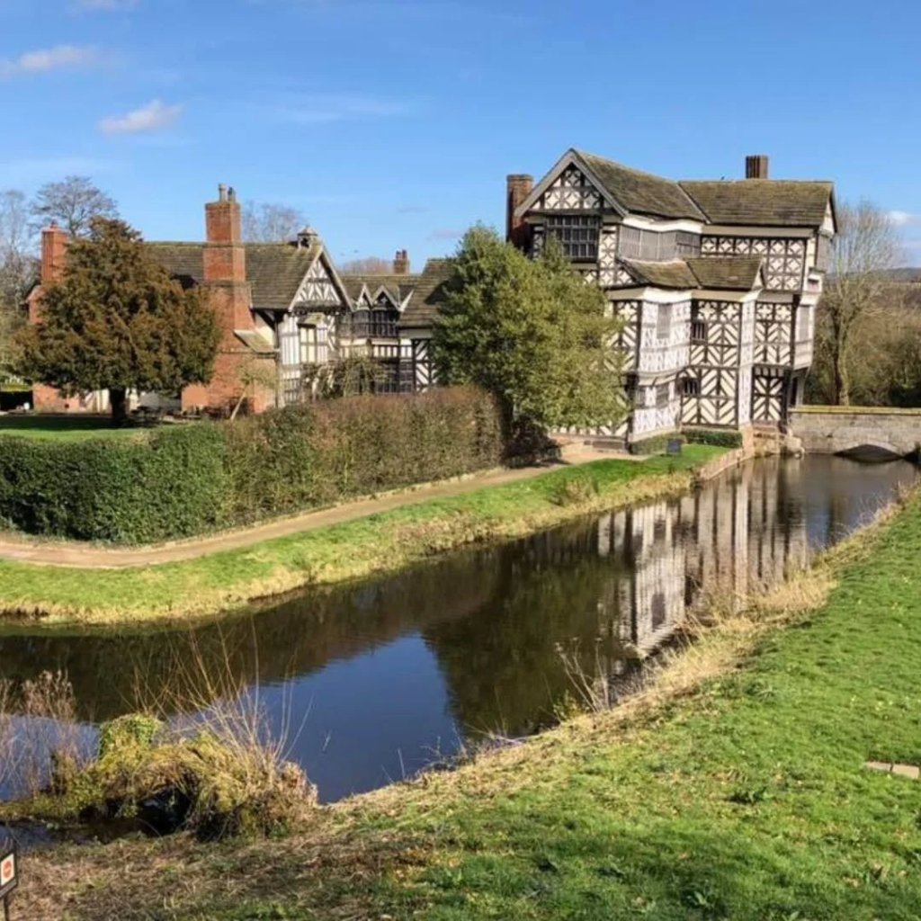
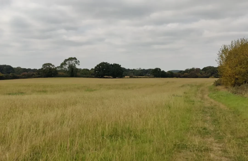
- Start near Little Moreton Hall and follow public footpaths heading out into the surrounding countryside.
- The route takes you through a mix of open farmland, quiet lanes and hedgerow-lined paths typical of this part of Cheshire.
- Pass around the grounds of Little Moreton Hall, a distinctive timber-framed building surrounded by a moat, before continuing along circular countryside routes.
- Follow waymarked paths toward Smallwood, linking into local footpaths that lead directly toward the village.
- Finish at the Blue Bell, a well-known countryside pub popular with walkers in the area.
Pub Finish
The Blue Bell – a traditional Cheshire village pub with a relaxed atmosphere and beer garden, commonly used as a stop after local walks.
👉 See full details in our guide to Countryside Pubs Near Sandbach
Navigation
Start point:
https://maps.google.com/?q=Little+Moreton+Hall
Finish pub:
https://maps.google.com/?q=Blue+Bell+Smallwood
Walk 6 – Swettenham Village & Quinta Arboretum Walk
Distance: ~2 miles
Difficulty: Easy
Start point: Swettenham village
Finish pub: Swettenham Arms
Route
- Start in Swettenham village near Swettenham Church.
- Walk along the footpath that runs beside the churchyard heading toward the Swettenham Arms.
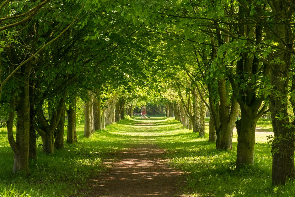
- From the pub entrance follow the path into Lovell Quinta Arboretum, a woodland reserve with marked walking trails.
- Follow the woodland paths through the arboretum, which wind through mature trees and open meadow areas.
- Continue along the signed loop paths that circle through the arboretum grounds.
- Follow the paths back toward Swettenham village, returning to the pub.
Pub stop
Swettenham Arms – a traditional countryside pub dating back several centuries and a popular stop for walkers exploring the Dane Valley.
Navigation
Start point:
https://maps.google.com/?q=Swettenham+Village
Finish pub:
https://maps.google.com/?q=Swettenham+Arms
Tips for Walking Around Sandbach
• Many local walks follow former railway lines and canal towpaths, making them relatively flat and accessible.
• Brereton Heath and the Dane Valley provide some of the best countryside scenery close to Sandbach.
• Several local pubs and cafés, including Swettenham Arms and Little Cow Shed, are popular stops for walkers and cyclists.
More Sandbach Pub Guides
If you’re exploring the area further, you may also want to read:
• Pubs in Sandbach
• Sandbach Pub Crawl Guide
• Best Beer Gardens in Sandbach